Kanada |
|
|
|
| Übersicht – Contents: | |
Diese Seite ist Teil des Projektes
Kanada |
|
|
|
| Übersicht – Contents: | |
Flaggen – Flags: |
|
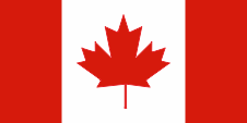 |
National-, Handels-, Staatsflagge und Gösch – national, merchant, state flag and jack, Seitenverhältnis – ratio = 1:2, Quelle/Source, nach/by: Corel Draw 4   |
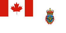 |
gemeinsame Flagge der Streitkräfte – common flag of the armed forces, Seitenverhältnis – ratio = 1:2, Quelle/Source, nach/by: Wikipedia (D) |
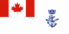 |
seit/since 2013, Marineflagge – naval flag, Seitenverhältnis – ratio = 1:2, Quelle/Source, nach/by: Wim Schuurmann in Vlag! Nr. 13 & Wikipedia (EN) |
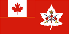 |
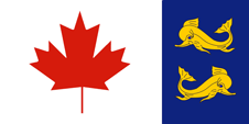
seit/since 2016, Flagge der Armee – flag of the army, Seitenverhältnis – ratio = 1:2, Quelle/Source, nach/by: Wikipedia (EN) |
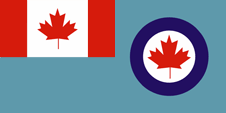 |
seit/since 1982, Flagge der Luftwaffe – flag of the air force, Seitenverhältnis – ratio = 1:2, Quelle/Source, nach/by: Wikipedia (EN) |
 |
Gösch der Küstenwache – coast guard jack, Seitenverhältnis – ratio = 1:2, Quelle/Source, nach/by: Governor General of Canada |
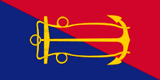 |
Flagge des Marineamtes – flag of the Naval Board, Seitenverhältnis – ratio = 1:2, Quelle/Source, nach/by: Flags of the World |
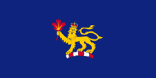 |
Flagge des Generalgouverneurs – flag of the Gouvernor General, Seitenverhältnis – ratio = 1:2, Quelle/Source, nach/by: Flags of the World |
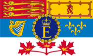 |
1962–2022, Flagge der Königin – flag of the Queen, Seitenverhältnis – ratio = 3:5, Quelle/Source, nach/by: Wappen und Flaggen aller Nationen   |
historische Flaggen – historical Flags: |
|
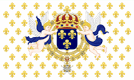 |
1608–1763, Flagge Frankreichs – flag of France, Quelle/Source, nach/by: Sodacan [CC BY-SA 3.0], via Wikimedia Commons  |
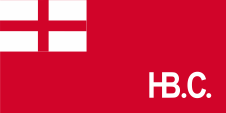 |
1682–1707, |
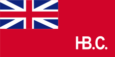 |
1707–1801, |
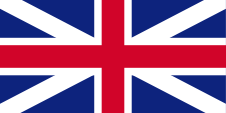 |
1713–1801, Union Flag → quasi Nationalflagge/national flag, Flagge von Großbritannien – flag of United Kingdom, Seitenverhältnis – ratio 1:2, Quelle/Source nach/by: Die Welt der Flaggen, thecanadianencyclopedia.ca |
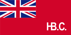 |
1801–1965, |
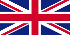 |
1801–1965, Union Flag → quasi Nationalflagge/national flag, Flagge von Großbritannien – flag of United Kingdom, Seitenverhältnis – ratio 1:2, Quelle/Source, nach/by: Wikipedia (EN), thecanadianencyclopedia.ca    |
 |
seit/since 1965, Union Flag → Zeremonial-Monarchieflagge, ceremonial monarchy flag, Flagge von Großbritannien – flag of United Kingdom, Seitenverhältnis – ratio 1:2, Quelle/Source, nach/by: Wikipedia (EN), thecanadianencyclopedia.ca    |
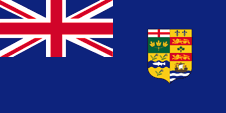 |
1870–1922, Staatsflagge – state flag, Seitenverhältnis – ratio = 1:2, Quelle/Source, nach/by: World Statesmen  |
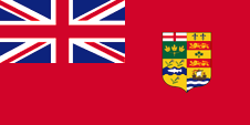 |
1892–1922, National- und Handelsflagge – national and merchant flag, Seitenverhältnis – ratio = 1:2, Quelle/Source, nach/by: World Statesmen  |
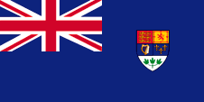 |
1922–1957, Staatsflagge – state flag, Seitenverhältnis – ratio = 1:2, Quelle/Source, nach/by: World Statesmen |
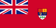 |
1922–1957, National- und Handelsflagge – national and merchant flag, Seitenverhältnis – ratio = 1:2, Quelle/Source, nach/by: World Statesmen |
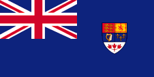 |
1957–1965, Staatsflagge – state flag, Seitenverhältnis – ratio = 1:2, Quelle/Source, nach/by: World Statesmen |
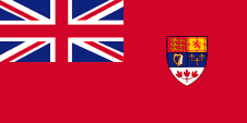 |
1957–1965, National- und Handelsflagge – national and merchant flag, Seitenverhältnis – ratio = 1:2, Quelle/Source, nach/by: World Statesmen |
Bedeutung/Ursprung der Flagge – Meaning/Origin of the Flag: |
|
| Die heutige Flagge Kanadas wurde am 15.02.1965 erstmals offiziell gehisst. Sie besteht aus drei senkrechten Streifen in Rot, Weiß und Rot im Verhältnis 1:2:1. Der weiße Streifen trägt in der Mitte ein rotes Ahornblatt. Die Flagge versinnbildlicht die Lage Kanadas zwischen den Weltmeeren Pazifik und Atlantik, die das Land im Westen und Osten begrenzen. Das Ahornblatt ist als kanadisches Symbol mindestens seit einhundert Jahren in Gebrauch, und ist heute Kanadas nationales Wahrzeichen. Die Farben Rot und Weiß wurden durch königliches Patent vom 21.11.1921 zu den offiziellen Landesfarben Kanadas erklärt. | The today's flag of Canada was officially hoisted for the first time on 15th of February in 1965. It consists in three vertical stripes in red, white and red in ratio 1:2:1. The white stripe carrys in the middle a red maple leaf. The flag portrays the position of Canada between the Pacific Ocean and the Atlantic Ocean, which border the country in the west and in the east. The maple leaf is as Canadian symbol in use leastways since one hundred years and is nowadays the national landmark of Canada. The colours red and white became declared to the official colours of the country Canada by a royal patent from 21st of November in 1921. |
| Das Rot der Flagge von Kanada ist exakt festgelegt und wird intepretiert als CMYK 0|100|100|0 oder Pantone 485. Soweit die Flaggen britischen Vorgaben folgen, gelten hier: Blau = Pantone 280, Rot = Pantone 186. | The red of the flag of Canada is precisely defined and is interpreted as CMYK 0/100/100/0 or Pantone 485. If the flags follow British specifications, the following also apply here: blue = Pantone 280, red = Pantone 186. |
| Am 05.05.2013 hat Kanada eine neue Marineflagge eingeführt. Sie entspricht der bis dato gültigen Gösch. | On 5th of May in 2013 Canada had introduced a new naval flag. It corresponds to the to date valid naval jack. |
| Bis zur Einführung der heutigen Flagge im Jahre 1965 folgte Kanada dem britischen Ensign-System. Die nationalen Flaggen waren vor dieser Zeit einfarbige blaue oder rote Ensigns, ein einfarbiges Flaggentuch mit einer Flaggendarstellung – dem britischen Union Jack – in der Oberecke. Der Union Jack wies auf die Verbindungen zu Großbritannien hin. Bei den Dienstflaggen, der Flaggen für Streitkräfte oder staatliche Dienststellen, lehn man sich noch heute an das Ensign-System an. |
Until the introduction of the current flag in 1965, Canada followed the
British Ensign system. Prior to that time, the national flags were plain blue or red ensigns, a single-coloured flag bunting with a representation of the flag - the British Union Jack - in the upper corner. The Union Jack indicated the ties to United Kingdom. The ensign system is still used today for official flags, the flags of the armed forces or government departments. |
Großbritannien hatte in Jahr 1864 ein Flaggensystem eingeführt, in dem:
Seit 1865 durften Schiffe von Kolonialregierungen einen Blue Ensign mit einem Badge (Abzeichen) im fliegenden Ende führen. Die jeweiligen Regierungen sollten entsprechene Bagdes zur Verfügung stellen. Handelsschiffe und seefahrende Privatpersonen aus Kolonien dürfen nur dann einen Red Ensign mit Badge führen, wenn von der britischen Admiralität eine entsprechende Erlaubnis für die Kolonie erteilt wurde. |
United Kingdom introduced a flag system in 1864 in which:
Since 1865 ships of
colonial governments were permitted to fly the Blue Ensign with a badge in
the flying end of the flag. The respective governments were asked to design
appropriate badges. Merchant ships and seafaring persons from colonies were
only permitted to use the Red Ensign with a badge, then also named Civil
Ensign, if permission has been given to the respective colony by the British
admiralty. |
| Quelle/Source: Wim Schuurmann in Vlag! Nr. 13, Flaggen Enzyklopädie, Die Welt der Flaggen, Flaggen Wappen Hymnen, Flaggen und Wappen der Welt | |
Wappen – Coat of Arms: |
|
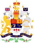 |
Wappen Kanadas – coat of arms of Canada, Quelle/Source: Corel Draw 4 |
Bedeutung/Ursprung des Wappens – Meaning/Origin of the Coat of Arms: |
|
| Das kanadische Staatswappen wurde in der heutigen Form am 21.11.1921, zusammen mit den Landesfarben, durch königliches Patent von König Georg V. verliehen. Das Wappenschild ist gevierteilt und zeigt die Heraldik von England (drei goldene Löwen auf Rot), Schottland (roter Löwe auf Gold), Irland (goldene Harfe auf Blau) und Frankreich (drei goldene Lilien auf Blau). Diese vier Länder sind die ursprüngliche Heimat eines großen Teils der kanadischen Bevölkerung. Vor 1921 befanden sich die Wappen von vier Provinzen in den Gevierten. In der unteren Spitze des Wappenschildes sieht man drei Ahornblätter, deren Farbe erst im Jahre 1957 von Grün auf Rot geändert wurde. Schildhalter sind der britische Löwe und das schottische Einhorn. Das Motto in dem blauen Spruchband lautet: "A MARI VSQVE AD MARE" → "Von Meer zu Meer". | The
Canadian coat of arms was adoped in the today's form on the 21st of November
in 1921, likewise the colours of the country, by a royal patent of King
George V. The blazon is quartered and shows the heraldry of England (three golden lions on red), Scotland (red lion on gold), Ireland (golden harp on blue) and France (three golden lilies on blue). Those four countries are the original home of a big part of the Canadian population. Until 1921 there were the coats of arms of four provinces in the quads. In the lower top of the blazon are to see three maple leafs. Its colour was changed not until the year 1957 from green into red. Shield holders are the British lion and the Scottish unicorn. The motto in the blue motto ribbon is: "A MARI VSQVE AD MARE" → "From Ocean to Ocean". |
| Quelle/Source: Flaggen Wappen Hymnen, Flaggen und Wappen der Welt | |
Flugzeugkokarde – aircraft roundel: |
|
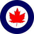 |
1946–1965, Flugzeugkokarde – aircraft roundel Quelle/Source: nach/by Wikipedia (EN) |
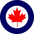 |
seit/since 1965, Flugzeugkokarde – aircraft roundel Quelle/Source: nach/by Wikipedia (EN) |
Landkarten – Maps: |
|
|
Lage – Position: |
|
|
Landkarte des Landes – Map of the Country: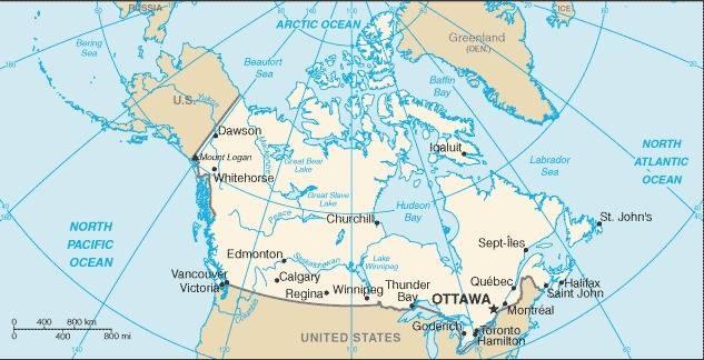 Quelle/Source: CIA World Factbook |
|
|
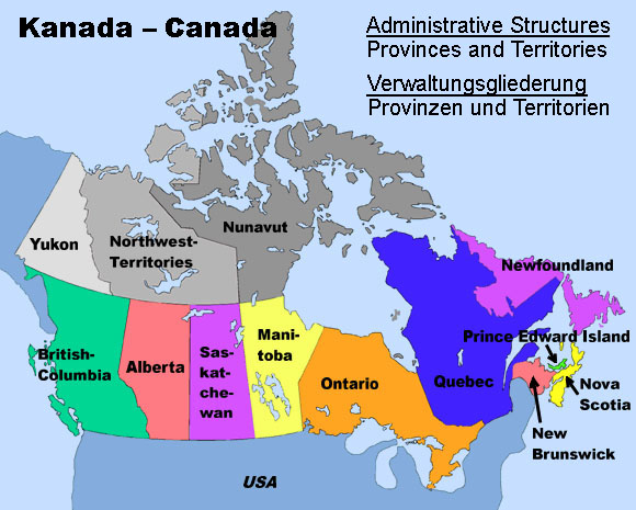 |
| Landkarte/Map: Volker Preuß |
|
|
Zahlen und Fakten – Numbers and Facts: |
|
|
|
|
|
|
|
|
|
|
|
|
|
|
|
|
|
|
|
Verwaltungsgliederung – administrative Structures: |
| 10 Provinzen – 10 Provinces | ||
| Name in Deutsch | Name in English | Nom en Français |
| Alberta | Alberta | Alberta |
| Britisch-Kolumbien | British Columbia | Colombie-Britannique |
| Manitoba | Manitoba | Manitoba |
| Neubraunschweig | New Brunswick | Nouveau-Brunswick |
| Neufundland | Newfoundland | Terre-Neuve |
| Neuschottland | Nova Scotia | Nouvelle-Écosse |
| Ontario | Ontario | Ontario |
| Prinz-Eduard-Insel | Prince-Edward-Island | Île-du-Prince-Édouard |
| Québec | Québec | Québec |
| Saskatchewan | Saskatchewan | Saskatchewan |
| 3 Territorien – 3 Territories | ||
| Name in Deutsch | Name in English | Nom en Français |
| Nordwest-Territorien | Northwest-Territories | Territoires du Nord-Ouest |
| Nunavut-Territorium | Nunavut Territory | Territoire du Nunavut |
| Yukon-Territorium | Yukon Territory | Territoire du Yukon |
| Landschaften – Landscapes: | ||
| Name in Deutsch | Name in English | Nom en Français |
| Labrador | Labrador | Labrador |
| Akadien | Acadia | Acadie |
Geschichte: |
| ca. 30000
Jahre v.Chr. · erste Besiedlung durch Ureinwohner ca. 1000 · Normannen erreichen die kanadische Ostküste 1497 · Giovanni Caboto (John Cabot), ein italienischer Seefahrer in Diensten Englands entdeckt Labrador, Neufundland und Kap Breton 1534–1535 · der Franzose Jacques Cartier erkundet den St.-Lorenz-Strom und nimmt das Land zu beiden Seiten für Frankreich in Besitz, ein Kolonisierungsversuch in der Nähe der heutigen Stadt Québec scheitert jedoch zunächst 16. Jhd. · England, Portugal und Spanien nehmen Fischereirechte wahr und errichten vorübergehend Fischereistützpunkte 1576 · Martin Frobisher, ein englischer Seefahrer, entdeckt die Küste von Baffin Island 17. Jhd. · Expeditionen unter Henry Hudson, William Baffin und Robert Bylot 1603–1606 · Kolonisierungsexpedition des Samuel de Champlain, erste Siedlungen entstehen 1608 · Champlain gründet Québec, Zusammenfassung aller französischen Besitzungen im heutigen Kanada als "Neufrankreich" 1663 · Neufrankreich wird französische Kronkolonie 1670 · englische Pelzhändler gründen die Hudson's Bay Company (HBC), die HBC kolonisiert in der Folgezeit ganz Kanada zwischen Neufrankreich den Rocky Mountains, Labrador und dem Nordrand der Hudson-Bucht 1679–1682 · der Franzose La Salle erforscht die Großen Seen und den Flusslauf des Mississippi 17.–18. Jhd. · französische Kolonisierung der Gegend um die Großen Seen, und entlang des Flusslaufs des Mississippi (Louisiana), die Gegend nördlich der Großen Seen wird Canada genannt 1713 · Friede von Utrecht, Frankreich muss Neubraunschweig, Neuschottland und die Insel Neufundland an Großbritannien abtreten 1763 · Friede von Paris, Frankreich muss alle nordamerikanischen Besitzungen an Großbritannien (Britisch-Nordamerika) abtreten, außer St. Pierre und Miquelon 1775–1776 · Abwehr verschiedener Angriffe von anti-britischen Rebellen aus Neuengland 1783 · Einwanderung von 35 000 königstreuen US-Amerikanern 1812–1814 · Abwehr verschiedener Angriffe von Truppen der USA 1824 · Neufundland wird britische Kronkolonie 1840 · Vereinigung der Provinzen Neuschottland, Neubraunschweig, Québec und Ontario zu einer Kolonie (Kanada) mit einer eigener Verfassung 1855 · Neufundland wird britisches Dominion (Kolonie mit eigenem Parlament) 1867 · Gründung der Konföderation Kanada (Dominion of Canada – mit einem eigenen Parlament) auf Grund von Autonomieforderungen, Konföderation durch die vier Gründungsprovinzen Neubraunschweig, Quebec, Ontario und Neuschottland 1869 · die Hudson's Bay Company (HBC) überträgt alle ihre territorialen und Hoheitsrechte an das britische Dominion of Canada 1870 · Bildung der Nordwest-Territorien aus den Gebieten der HBC, Rupertsland und Nordwestliches Territorium, die Arktischen Inseln kommen unter direkte britische Verwaltung 1870 · Bildung der Provinz Manitoba durch Herauslösung aus den Nordwest-Territorien 1871 · Britisch-Kolumbien wird kanadische Provinz 1876 · Bildung des Keewatin-Territoriums durch Herauslösung aus den Nordwest-Territorien 1880 · Eingliederung der Arktischen Inseln in die Nordwest-Territorien 1881 · Vergrößerung der Provinz Manitoba durch Angliederung von Gebieten des Keewatin-Territoriums 1882 · Vergrößerung der Provinz Ontario im Nordwesten durch Angliederung von Teilen West-Rupertslands 1883 · Bildung der Territorien Alberta, Athabaska, Saskatchewan und Assiniboia durch Herauslösung aus den Nordwest-Territorien 1895 · Bildung des Franklin-Distrikts und des Mackenzie-Distrikts innerhalb der Nordwest-Territorien, Bildung des Ungava-Territoriums auf Labrador, des Yukon-Territoriums im äußersten Nordwesten durch Herauslösung aus den Nordwest-Territorien 1898 · Vergrößerung der Provinz Quebéc im Nordwesten durch Angliederung von Teilen des Ungava-Territoriums 1905 · Eingliederung von Keewatin als Distrikt in die Nordwest-Territorien, Alberta und Saskatchewan werden durch Anschluss von Assiniboia und Athabaska vergrößert, und als Provinzen an das Dominion of Canada angeschlossen 1912 · Vergrößerung der Provinz Ontario durch Angliederung der Reste West-Rupertslands, Vergrößerung der Provinz Quebéc durch Angliederung der Reste des Ungava-Territoriums, nochmalige Vergrößerung der Provinz Manitoba durch Angliederung der südlichen Gebiete des Keewatin-Distrikts 1914–1918 · Erster Weltkrieg, das Dominion of Canada muss Truppen für Großbritannien stellen 1925 · Ausdehnung der Grenzen der Nordwest-Territorien als Sektorengrenzen bis hin zum Nordpol 01.12.1931 · Westminster-Statut, Großbritannien gewährt Kanada volle eigene Wehrhoheit sowie außenpolitische Souveränität, bleibt jedoch Dominion im Rahmen des Britischen Commonwealth 1934 · Neufundland wird wegen wirtschaftlicher Probleme wieder durch Großbritannien verwaltet 1939–1945 · das britische Dominion Kanada greift an der Seite Großbritanniens und der USA in den Zweiten Weltkrieg ein, die USA errichten im britischen Dominion Neufundland Militärstützpunkte 1949 · Kanada ist Gründungsmitglied der NATO, Aufhebung der britischen Kontrolle über die Verfassung dadurch Erweiterung der Rechte des kanadischen Parlaments 31.03.1949 · Neufundland schließt sich nach Volksabstimmung als 10. Provinz dem Staat Kanada an, die US-Militärstützpunkte bleiben erhalten 1950–1953 · Kanada engagiert sich auf Seiten der USA im Koreakrieg 1968 · Gründung der Partei von Québec (Parti Québécois, PQ), um eine vollständige Trennung von Kanada zu erreichen 1976 · Sieg der frankokanadischen separatistischen Parti Québécois in Quebec, Forderungen nach Unabhängigkeit für Quebec, Französisch wird in Québec Amtssprache 1980 · Volksabstimmung für Unabhängigkeit in Quebec (knapp abgelehnt) 1982 · neue Verfassung, Großbritannien verzichtet auf alle der per britischem Gesetz zulässige Verfügungsgewalt über Kanada 1990 · Forderungen nach Unabhängigkeit für Quebec 1995 · Volksabstimmung für Unabhängigkeit in Quebec (knapp abgelehnt) 01.04.1999 · Bildung des Eskimo Nunavut-Territoriums mit einer eigenen Regionalregierung durch Ausgliederung aus den Nordwest-Territorien auf Kosten des Keewatin-Distrikts, fast des gesamten Franklin-Distrikts und großer Teile des Mackenzie-Distrikts |
History: |
| ca. 30000
years B.C. · first settlement by native tribes ca. 1000 · Normans reach the Canadian eastern coast 1497 · Giovanni Caboto (John Cabot), an Italian seafarer in the services of England discovers Labrador, Newfoundland and Cape Breton 1534–1535 · the Frenchman Jacques Cartier explores the Saint-Lawrence-Stream and appropriates the land on both sides for France, but an attempt of colonization near the today's City of Québec failes initially 16th cent. · England, Portugal and Spain exercise fishing rights and establish momentaryly fishery bases 1576 · Martin Frobisher, an English seafarer, discovers the coast of Baffin Island 17th cent. · expeditions under Henry Hudson, William Baffin and Robert Bylot 1603–1606 · expedition of colonization by Samuel de Champlain, first settlements arise 1608 · Champlain founds Québec, summary of all French possessions in the today's Canada as "New France" 1663 · New France becomes a French crown colony 1670 · English furriers establish the Hudson's Bay Company (HBC), the HBC colonizes in the afteryears whole Canada between New France, the Rocky Mountains, Labrador and the northern rand of the Hudson Bay 1679–1682 · the Frenchman La Salle explores the Great Lakes and the river Mississippi 17th–18th cent. · French colonization of the region around the Great Lakes and along the river Mississippi (Louisiana), the region northern of the Great Lakes is named Canada 1713 · Peace of Utrecht, France has to cede the today's New Brunswick, Nova Scotia and the Island of Newfoundland to United Kingdom 1763 · Peace of Paris, France has to cede all its north american possessions to United Kingdom (British Northern America), except St. Pierre and Miquelon 1775–1776 · defence of diverse attacks by anti-British rebels from New England 1783 · immigration of 35 000 loyal US-Americans 1812–1814 · defence of diverse attacks of troops of the USA 1824 · Newfoundland becomes a British crown colony 1840 · union of the provinces of Nova Scotia, New Brunswick, Québec and Ontario in one colony (Kanada) with an own constitution 1855 · Newfoundland becomes a British Dominion (colony with own parliament) 1867 · establishment of the Confederation of Canada (Dominion of Canada – with an own parliament) because of demands for autonomy, confederation by the four founding provinces New Brunswick, Québec, Ontario and Nova Scotia 1869 · the Hudson's Bay Company (HBC) cedes all their territorial rights and prerogatives to the British Dominion of Canada 1870 · formation of the Northwest-Territories from the former properties of the HBC, Rupertsland and Northwestern Territories, the Arctic Islands come under direct British administration 1870 · establishment of the Province of Manitoba by dividing of the Northwest Territories 1871 · British Columbia becomes a Canadian province 1876 · establishment of the Keewatin Territory by dividing off the Northwest Territories 1880 · incorporation of the Arctic Islands into the Northwest Territories 1881 · enlargement of the Province of Manitoba by annexation of territories of the Keewatin Territory 1882 · enlargement of the Province of Ontario in the northwest by annexation of parts of Western Rupertsland 1883 · establishment of the Territories Alberta, Athabaska, Saskatchewan and Assiniboia by dividing off the Northwest Territories 1895 · establishment of the District of Franklin and the District of Mackenzie within the Northwest Territories, establishment of the Ungava Territory on Labrador, of the Yukon Territory in the outer northwest by dividing off the Northwest Territories 1898 · enlargement of the Province of Quebéc in the northwest by annexation of parts of the Ungava Territory 1905 · incorporation of Keewatin as district in the Northwest Territories, Alberta and Saskatchewan get enlarged by annexion of Assiniboia and Athabaska and joined as provinces into the Dominion of Canada 1912 · enlargement of the Province of Ontario by annexation of the leftovers of Western Rupertsland, enlargement of the Province of Quebéc by annexation of the leftovers of the Ungava Territory, once again enlargement of the Province of Manitoba by annexation of the southern regions of the District of Keewatin 1914–1918 · First World War, the Dominion of Canada has to give troops for United Kingdom 1925 · extension of the borders of the Northwest Territory as sector's frontiers towards the North Pole 1st of December 1931 · Statute of Westminster, United Kingdom grants Canada full military sovereignty as well in foreign policy 1934 · Newfoundland is administrated by United Kingdom again because of economical problems 1939–1945 · the British Dominion Canada intervenes on the side of United Kingdom and the USA in the Second World War, the USA build military bases in the British Dominion of Newfoundland 1949 · Canada is founding member of the NATO, dissolution of the British control over the constitution thereby extension of the rights of the Canadian parliament 31st of March 1949 · Newfoundland joines after a plebiscite to the State of Canada as 10th province, the USA military bases stay 1950–1953 · Canada is committed on the sides of the USA in the Korean War 1968 · foundation of the Franko-Canadian and separatist Party of Québec (Parti Québécois, PQ) to achieve a full separation from Canada 1976 · victory of the Parti Québécois in Québec, demands for Québec`s independence, French becomes official language in Québec 1980 · plebiscite for independence in Québec (justly rejected) 1982 · new constitution, United Kingdom disclaims for all by British laws given power over Canada 1990 · demands for Québec`s independence 1995 · plebiscite for independence in Québec (justly rejected) 1st of April 1999 · establishment of the Eskimo Nunavut Territory with an own regional government by dividing off the Northwest Territories at the cost of the District of Keewatin, of nearly the whole District of Franklin and of large parts of the District of Mackenzie |
| Quelle/Source: Atlas zur Geschichte, Wikipedia (D), World Statesmen, Discovery '97 |
Ursprung des Landesnamens – Origin of the Country's Name: |
|
| Der Name des Landes geht auf die Indianer vom Stamme der Irkoesen zurück. In ihrer Sprache bedeutet kanata "Dorf" oder "Siedlung". Der französische Forscher Jacques Cartier übertrug die Wegbeschreibung zu einem kanata auf die ganze Gegend, was sich als Name für die Region sehr schnell durchsetzte. | The name of the country goes back to the Indians from the tribe of the Irkoese. In their language, kanata means "village" or "settlement ." The French researcher Jacques Cartier transferred the directions to a kanata to the whole area, which succeed successfully and very quickly as the name for the region. |
| Quelle/Source: Handbuch der geographischen Namen, Wikipedia (D) | |