Diese Seite ist Teil des Projektes
The Regions of France
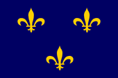
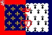
Die bis zur Französischen Revolution bestehenden Provinzen (bzw. Gouvernements) waren historisch gewachsene Gebilde, die sich oft aus ehemaligen Lehensgebieten der französischen Krone, historischen Grafschaften und Herzogtümern heraus entwickelt hatten, oft über hunderte von Jahren bestanden und Regionalität (kulturelle Besonderheiten und regionale Sprachen) bewahrt hatten. Der Französischen Revolution waren solche Erscheinungen natürlich nicht erwünscht, und im Rahmen ihrer blutigen und gewalttätigen Gleichmacherei wurden jegliche regionale Bezüge ausgemerzt. Kurz nach der Revolution wurden die Provinzen aufgelöst und Frankreich in viele kleine Départements aufgeteilt, die annähernd gleich groß sein und den gleichen Status haben sollten, gesteuert über Präfekte der Zentralverwaltung in Paris. Benannt wurden die Départements nach Flüssen oder Gebirgen, um auf keinen Fall den Namen einer der alten Provinz zu verwenden. Es gelang jedoch nicht, die Verbindungen der Einwohner Frankreichs zu ihrer jeweiligen historisch gewachsenen Region abzuschneiden, so dass im Jahre 1960 wieder Regionen geschaffen wurden. Von wirklicher Eigenverantwortung kann dabei kaum die Rede sein. Die Regionen sollen lediglich die wirtschaftliche, soziale, gesundheitliche, kulturelle und wissenschaftliche Entwicklung der Region fördern, Wohnraum und Wohnverhältnisse im Auge behalten und bei bestimmten Themen unterstützen, z. B. bei: Städtebaupolitik, Stadtsanierung, Regionalplanung, Bewahrung der regionalen Identität und Förderung der Regionalsprachen. Bei der Bildung der Regionen wurden Départements, die in einer bestimmten historischen Provinz lagen, zu einer historisch oft gleichnamigen Region administrativ zusammengefasst. Die dabei entstandenen Gebilde deckten sich nur annähernd mit den Grenzen historischer Provinzen. Im streng zentralistischen Frankreich wird jedoch jedwede verantwortliche Regionalität vermieden. Die Regionen haben noch nicht mal eigene Siegel, mit denen eigene rechtsverbindliche Beschlüsse gekennzeichnet werden könnten. So etwas ist gar nicht vorgesehen. Von daher ist alles, was Wappen oder Flaggen angeht absolut ohne Belang. Die Logos der Regionen werden allgemein verwendet, dabei auch schon mal farblich umgekehrt und auch beliebig auf Flaggen oder Bannern platziert. Regeln gibt es keine, es sind keine offiziellen Symbole. Die Logos und Flaggen der Regionen sehen darum oft aus wie Firmenlogos, lieblos, unhistorisch, technokratisch und modernistisch. Darum gibt es den meisten dieser Regionen es eine Art von inoffiziellen Wappenflaggen, die an historische heraldische Vorbilder erinnern sollen. Diese haben aber lediglich schmückenden Charakter und sind kein Symbol hoheitlicher Aufgaben. Die 1960 angelegten Regionen wurden 2014 sogar in Frage gestellt und eine Gebietsreform beschlossen – zentral von Paris aus – welche die Anzahl der Regionen durch Fusionen auf fast die Hälfte verringerte. Die Regionen und ihre Organe wurden dazu noch nicht mal gefragt. |
The provinces (or governorates) that existed until the French Revolution
were historically grown entities that had often developed from former
fiefdoms of the French crown, historical counties and duchies, often existed
for hundreds of years and had preserved regional characteristics (cultural
peculiarities and regional languages). Such phenomena were naturally undesirable to the French Revolution, and in the context of its bloody and violent egalitarianism, all regional references were eradicated. Shortly after the Revolution, the provinces were dissolved and France was divided into many small départements, which were to be approximately the same size and have the same status, controlled by prefects of the central administration in Paris. The departments were named after rivers or mountains so as not to use the names of any of the old provinces. However, it was not possible to sever the ties between the inhabitants of France and their respective historically grown regions, so that in 1960 regions were created again. There can hardly be said to be any real autonomy. The regions are only supposed to promote the economic, social, health, cultural and scientific development of the region, keep an eye on housing and living conditions, and provide support in some areas, e.g. urban development policy, urban regeneration, regional planning, preservation of regional identity and promotion of regional languages. When the regions were formed, departments located in a particular historical province were administratively grouped together into a region that often had the same historical name. The resulting entities only roughly corresponded to the boundaries of historical provinces. In strictly centralised France, however, any form of responsible regionalism is avoided. The regions do not even have their own seals with which to mark their own legally binding decisions, because there are no plans to introduce such a thing. Therefore, anything to do with coats of arms or flags is completely irrelevant. The logos of the regions are used generally, sometimes with the colours reversed and placed arbitrarily on flags or banners. There are no rules, as they are not official symbols. The logos and flags of the regions therefore often look like company logos: Unloving, unhistorical, technocratic and modernistic. That is why most of these regions have a kind of unofficial heraldic flag, which is intended to recall historical heraldic models. However, these are merely decorative in nature and are not a symbol of sovereign functions. The regions created in 1960 were even called into question in 2014, and a territorial reform was decided – centrally from Paris – which reduced the number of regions by almost half through mergers. The regions and their institutions were not even consulted on this matter. |
|
|
|
|
Wikipedia-Link zu den Regionen Frankreichs: hier klicken FOTW-Link zu den Regionen Frankreichs: hier klicken |
Wikipedia link to the regions of France: click here FOTW link to the regions of France: click here |
Landkarte der Regionen Frankreichs |
Map of the regions of France |
| Gliederung seit 2014 | Structure since 2014 |
![]() |
|
| Landkarte/Map: Volker Preuß | |
Auvergne-Rhône-Alpes |
|
|
|
|
|
deutscher Name, bzw. übersetzt: Auvergne-Rhone-Alpen |
English name, or translated: Auvergne-Rhone-Alps |
|
|
|
|
Sitz des Regionalpräfekten: Lyon, bestehend aus 13 Départements,
Fläche: 70.795,00 km², Einwohner: 8.114.400 (2021) |
Seat of the Regional Prefect: Lyon, consisting of 13 Departments,
area: 27.334,00 sq.mi., population: 8.114.400 (2021) |
|
|
|
| mögliche Logoflagge – possible logo flag: | |
|
|
|
![]() ![]() ![]() |
|
|
|
|
| inoffizielle Wappenflagge – unofficial heraldic flag: | |
|
|
|
![]() ![]() ![]() |
|
|
|
|
| Quellen/Sources: Wikipedia (FR), Ngagnebin, Public domain, via Wikimedia Commons, Wikipedia (DE) | |
Bourgogne-Franche-Comté |
|
|
|
|
|
deutscher Name, bzw. übersetzt: Burgund-Freigrafschaft |
English name, or translated: Burgundy-Free County |
|
|
|
|
Sitz des Regionalpräfekten: Dijon, bestehend aus 8 Départements,
Fläche: 47.963,14 km², Einwohner: 2.800.200 (2021) |
Seat of the Regional Prefect: Dijon, consisting of 8 Departments,
area: 18.518,58 sq.mi., population: 2.800.200 (2021) |
|
|
|
| mögliche Logoflagge – possible logo flag: | |
|
|
|
![]() ![]() ![]() |
|
|
|
|
| inoffizielle Wappenflagge – unofficial heraldic flag: | |
|
|
|
![]() ![]() ![]() |
|
|
|
|
| Quellen/Sources: Agence Dartagnan, following: Geraldiker, CC BY-SA 4.0, via Wikimedia Commons, Wikipedia (DE) | |
Bretagne |
|
|
|
|
|
deutscher Name, bzw. übersetzt: Bretagne |
English name, or translated: Brittany |
|
mehr Infos zur historischen Bretagne ← hier klicken |
more information about the historical Brittany ← click here |
|
|
|
|
Sitz des Regionalpräfekten: Rennes, bestehend aus 4 Départements,
Fläche: 27.407,75 km², Einwohner: 3.394.600 (2021) |
Seat of the Regional Prefect: Rennes, consisting of 4 Departments,
area: 10.582 sq.mi., population: 3.394.600 (2021) |
|
|
|
| mögliche Logoflagge – possible logo flag: | |
|
|
|
![]() ![]() ![]() |
|
|
|
|
| inoffizielle Wappenflagge – unofficial heraldic flag: | |
|
|
|
![]() ![]() ![]() ![]() |
|
|
|
|
| Quellen/Sources: Wikipedia (FR), Flagge, nach: Wikipedia (DE), Wikipedia (DE) | |
Centre-Val de Loire |
|
|
|
|
|
deutscher Name, bzw. übersetzt: Zentrum-Loiretal |
English name, or translated: Centre-Loire Valley |
|
|
|
|
Sitz des Regionalpräfekten: Orléans, bestehend aus 6 Départements,
Fläche: 39.469,75 km², Einwohner: 2.573.300 (2021) |
Seat of the Regional Prefect: Orléans, consisting of 6 Departments,
area: 15.239 sq.mi., population: 2.573.300 (2021) |
|
|
|
| mögliche Logoflagge – possible logo flag: | |
|
|
|
![]() ![]() ![]() |
|
|
|
|
| inoffizielle Wappenflagge – unofficial heraldic flag: | |
|
|
|
![]() ![]() ![]() |
|
|
|
|
| Quellen/Sources: Wikipedia (FR), User: Andrwsc, Public domain, via Wikimedia Commons, Wikipedia (DE) | |
Grand Est |
|
|
|
|
|
deutscher Name, bzw. übersetzt: Groß-Ost |
English name, or translated: Greater East |
|
|
|
|
Sitz des Regionalpräfekten: Straßburg (Strasbourg), bestehend aus 10 Départements, Fläche: 57.704,90 km², Einwohner: 5.561.300 (2021) |
Seat of the Regional Prefect: Straßburg (Strasbourg), consisting of 10 Departments, area: 22.280 sq.mi., population: 5.561.300 (2021) |
|
|
|
| mögliche Logoflagge – possible logo flag: | |
|
|
|
![]() ![]() ![]() |
|
|
|
|
| Quellen/Sources: Wikipedia (FR), Flags of the World, Wikipedia (DE) | |
Hauts-de-France |
|
|
|
|
|
deutscher Name, bzw. übersetzt: Oberfrankreich, Nordfrankreich |
English name, or translated: Upper France, Northern France |
|
|
|
|
Sitz des Regionalpräfekten: Lille, bestehend aus 5 Départements,
Fläche: 32.002,07 km², Einwohner: 5.995.300 (2021) |
Seat of the Regional Prefect: Lille, consisting of 5 Departments,
area: 12.356 sq.mi., population: 5.995.300 (2021) |
|
|
|
| mögliche Logoflagge – possible logo flag: | |
|
|
|
![]() ![]() ![]() |
|
|
|
|
| inoffizielle Wappenflagge – unofficial heraldic flag: | |
|
|
|
![]() ![]() ![]() |
|
|
|
|
| Quellen/Sources: Agence Dartagnan, following: SiBr4; base files by Patricia.fidi and Superbenjamin, CC BY-SA 4.0, via Wikimedia Commons, Wikipedia (DE) | |
Île-de-France |
|
|
|
|
|
deutscher Name, bzw. übersetzt: Zentralfrankreich, Franzien |
English name, or translated: Greater Paris Region, Central France, Francia |
|
mehr Infos zur historischen Île-de-France ← hier klicken |
more information about the historical Greater Paris Region (Francia) ← click here |
|
|
|
|
Sitz des Regionalpräfekten: Paris, bestehend aus 8 Départements,
Fläche: 12.064,55 km², Einwohner: 12.317.300 (2021) |
Seat of the Regional Prefect: Paris, consisting of 8 Departments,
area: 4.658 sq.mi., population: 12.317.300 (2021) |
|
|
|
| mögliche Logoflagge – possible logo flag: | |
|
|
|
![]() ![]() ![]() |
|
|
|
|
| inoffizielle Wappenflagge – unofficial heraldic flag: | |
|
|
|
![]() ![]() ![]() ![]() |
|
|
|
|
| Quellen/Sources: Region Île-de-France, Flagge, nach: Die Welt der Flaggen, Wikipedia (DE) | |
Corse |
|
|
|
|
|
deutscher Name, bzw. übersetzt: Korsika |
English name, or translated: Corsica |
|
mehr Infos zum historischen Korsika ← hier klicken |
more information about the historical Corsica ← click here |
|
|
|
|
Sitz des "Collectivité territoriale unique": Ajaccio, bestehend aus 2 Départements,
Fläche: 8.759,82 km², Einwohner: 347.600 (2021) |
Seat of the "Collectivité territoriale unique": Ajaccio, consisting of 2 Departments,
area: 3.382 sq.mi., population: 347.600 (2021) |
|
|
|
| mögliche Logoflagge – possible logo flag: | |
|
|
|
![]() ![]() ![]() |
|
|
|
|
| inoffizielle Wappenflagge – unofficial heraldic flag: | |
|
|
|
![]() ![]() ![]() ![]() |
|
|
|
|
| Quellen/Sources: Wikipedia (FR), Flagge, nach: Die Welt der Flaggen, Wikipedia (DE) | |
Normandie |
|
|
|
|
|
deutscher Name, bzw. übersetzt: Normandie |
English name, or translated: Normandy |
|
mehr Infos zur historischen Normandie ← hier klicken |
more information about the historical Normandy ← click here |
|
|
|
|
Sitz des Regionalpräfekten: Rouen, bestehend aus 5 Départements,
Fläche: 30.149,17 km², Einwohner: 3.328.000 (2021) |
Seat of the Regional Prefect: Rouen, consisting of 5 Departments,
area: 11.640,6 sq.mi., population: 3.328.000 (2021) |
|
|
|
| mögliche Logoflagge – possible logo flag: | |
|
|
|
![]() ![]() ![]() |
|
|
|
|
| inoffizielle Wappenflagge – unofficial heraldic flag: | |
|
|
|
![]() ![]() ![]() |
|
|
|
|
| Quellen/Sources: Wikipedia (FR), Flagge, nach:Wikipedia (D), Wikipedia (DE) | |
Nouvelle-Aquitaine |
|
|
|
|
|
deutscher Name, bzw. übersetzt: Neu-Aquitanien |
English name, or translated: New Aquitaine |
|
mehr Infos zum historischen Aquitanien ← hier klicken |
more information about the historical Aquitaine ← click here |
|
|
|
|
Sitz des Regionalpräfekten: Bordeaux, bestehend aus 12 Départements,
Fläche: 84.749,10 km², Einwohner: 6.069.400 (2021) |
Seat of the Regional Prefect: Bordeaux, consisting of 12 Departments,
area: 32.721,6 sq.mi., population: 6.069.400 (2021) |
|
|
|
| mögliche Logoflagge – possible logo flag: | |
|
|
|
![]() ![]() ![]() |
|
|
|
|
| inoffizielle Flagge – unofficial flag: | |
|
|
|
![]() ![]() ![]() |
|
|
|
|
| Quellen/Sources: Wikipedia (FR), Chabe01, Public domain, via Wikimedia Commons, Wikipedia (DE) | |
Occitanie |
|
|
|
|
|
deutscher Name, bzw. übersetzt: Okzitanien |
English name, or translated: Occitania |
|
|
|
|
Sitz des Regionalpräfekten: Toulouse, bestehend aus 13 Départements,
Fläche: 73.412,15 km², Einwohner: 6.022.200 (2021) |
Seat of the Regional Prefect: Toulouse, consisting of 13 Departments,
area: 28.344,5 sq.mi., population: 6.022.200 (2021) |
|
|
|
| mögliche Logoflagge – possible logo flag: | |
|
|
|
![]() ![]() ![]() |
|
|
|
|
| inoffizielle Flagge – unofficial flag: | |
|
|
|
![]() ![]() ![]() |
|
|
|
|
| Quellen/Sources: Wikipedia (FR), Thom.lanaud, CC BY-SA 4.0, via Wikimedia Commons, Wikipedia (DE) | |
Pays de la Loire |
|
|
|
|
|
deutscher Name, bzw. übersetzt: Länder der Loire |
English name, or translated: Countries of the Loire |
|
|
|
|
Sitz des Regionalpräfekten: Nantes, bestehend aus 5 Départements,
Fläche: 32.363,53 km², Einwohner: 3.854.000 (2021) |
Seat of the Regional Prefect: Nantes, consisting of 5 Departments,
area: 12.495,5 sq.mi., population: 3.854.000 (2021) |
|
|
|
| mögliche Logoflagge – possible logo flag: | |
|
|
|
![]() ![]() ![]() |
|
|
|
|
| inoffizielle Wappenflagge – unofficial heraldic flag: | |
|
|
|
![]() ![]() ![]() |
|
|
|
|
| Quellen/Sources: LELIEVRE Olivier, Patricia.fidi, original author: Hervé Pinoteau in 1976., CC0, via Wikimedia Commons, Wikipedia (DE) | |
Provence-Alpes-Côte d’Azur (Région Sud) |
|
|
|
|
|
deutscher Name, bzw. übersetzt: Provence-Alpen-Côte d’Azur (Südregion) |
English name, or translated: Provence-Alps-French Riviera (Southern Region) |
|
|
|
|
Sitz des Regionalpräfekten: Marseille, bestehend aus 6 Départements,
Fläche: 31.688,83 km², Einwohner: 5.127.800 (2021) |
Seat of the Regional Prefect: Marseille, consisting of 6 Departments,
area: 12.235 sq.mi., population: 5.127.800 (2021) |
|
|
|
| mögliche Logoflagge – possible logo flag: | |
|
|
|
![]() ![]() ![]() |
|
|
|
|
| inoffizielle Wappenflagge – unofficial heraldic flag: | |
|
|
|
![]() ![]() ![]() |
|
|
|
|
| Quellen/Sources: Wikipedia (FR), Diades, CC BY-SA 3.0, via Wikimedia Commons, Wikipedia (DE) | |